Archive
More rain, more floods
It has been raining here in Alice Springs. Sometimes heavily. Very heavily. For days. And it’s cold. Most undesertlike.
You may have read about it in the news here or even seen the video here. Sadly, one person has already been swept to their death. And here’s today’s local news bulletin.
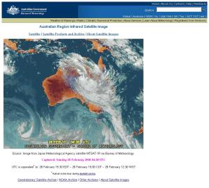
A monsoonal low pressure system has drifted south and is dumping lots of water upon the desert of Central Australia.You can check the Bureau of Meteorology for the latest weather for Alice Springs & the Northern Territory.
Radar pictures are also available there.
The Todd River is not only flowing but flooding. Again. But higher this time.
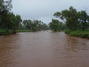
Todd River on Saturday 27 February 2010. The river has risen much further since this photo was taken.
We’ve been on flood alert (River Watch) for a few days with the risk of flood going up, going down, going back up again. As I type it’s on Level B. You can see a flood map & information brochure here.
I strolled down to the river yesterday in the late morning, snapping photos as I waltzed along the path in the drizzle & rain.
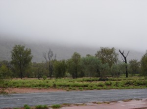
View of the MacDonnell Ranges from Stephens Road, Alice Springs. The cloud has tumbled down both sides of the mountains. Very novel & exciting. Note how green the vegetation is, we're not that used to this much greenery!
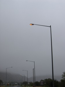
Street lamps have stayed on during the daytime as it's so dull. Stephens Road looking towards Heavitree Gap.
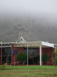
The Comfort Inn is usually photographed with the red mountain backdrop & startlingly clear blue skies. But not today.
The Comfort Inn Outback, Alice Springs.

The Todd flows under Taffy Pick bridge out of town, heading for the Gap. This crossing was closed today so the river has risen quite a lot since I took this photo. All the low level causeways have been shut for days.
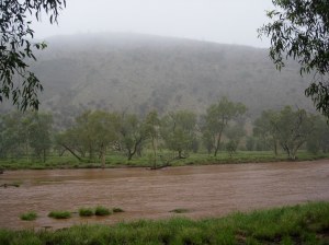
The Todd River as viewed from South Tce just around the corner from Taffy Pick bridge. Looks quite rural, all we need is a herd of cows grazing. 🙂
Today I had to head out to the airport. All causeway crossings except for Stott Tce were shut. I cannot access Stott Tce from my suburb near the Golf Course so it was detour time through the power station land. (It’s the dotted line off Tuncks Road.)
Huge potholes, filled with water slowed the traffic right down. Then it was slow moving on to Sadadeen Road onto Stott Tce and through the roundabout near Imparja TV station (cnr of South Tce).
The river is a lot higher today than appears in these photos but I’m not about to venture out again today with the camera.

The rain got heavier for my walk home up Stephens Road. You can barely see the houses in the distance. It was around this time I figured out my old, faithful Goretex is no longer waterproff. Thank goodness for Icebreaker t-shirts!
Icebreaker clothing. Highly recommended for walking in the rain, doesn’t matter if they get wet you’ll still be warm & dry.
